Physical visualization
Introduction
See also:
Examples
Thesis project board
See lego-compatible thesis project board (a project we initiated in Nov 2012).
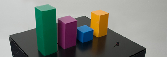
Yvonne Jansen et al. Empirical Investigation of Physical Visualizations
(An Empirical Investigation of Physical Visualizations, retrieved nov 22, 2012)
Wable
“The personal feeds from webapplications like Plazes, Flickr, and Last.fm tell much about the activity of an individual on the internet. In this project we aim to explore how you can visualize the changes of your web identity over time and create a physical link between your virtual and real identity. The interface consists of both a physical table and a web application. This direct feedback from your web identity is customizable and can be connected to any RSS feed.” (Wable, retrieved nov 22, 2012).
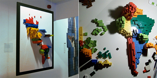
3D Infographic Maps Built with Lego
“Samuel Granados has discovered an efficient way to display geographical data in 3D physical reality. Just use Lego [samuelgranados.es]. One side of the map reveals the emigrants of each zone, the opposite shows the immigrants (both represented by the volume of the pieces).” (3D Infographic Maps Built with Lego, retrieved nov. 22 2012)
Links
Indexes
- List of passive physical visualizations (2012, Aviz, visual analytics project)
- List of active physical visualizations (2012, Aviz)
Research groups and people
- Aviz is a multidisciplinary team of INRIA aiming at improving the analysis and visualization of large and complex datasets by combining analysis methods with interactive visualizations
Bibliography
- Yvonne Jansen, Pierre Dragicevic, and Jean-Daniel Fekete (2012) Investigating Physical Visualizations (Poster). IEEE VisWeek 2012 Electronic Conference Proceedings, Oct 2012, Seattle, Washington, USA, United States. In press.
Acknowledgement
Initial sample examples were found through http://www.aviz.fr/Research/PassivePhysicalVisualizations (Yvonne Jansen, Pierre Dragicevic, and Jean-Daniel Fekete)

