File:Accutrans-from-maperitive3D-dae.png
Jump to navigation
Jump to search

Size of this preview: 800 × 504 pixels. Other resolution: 2,358 × 1,486 pixels.
Original file (2,358 × 1,486 pixels, file size: 492 KB, MIME type: image/png)
Summary
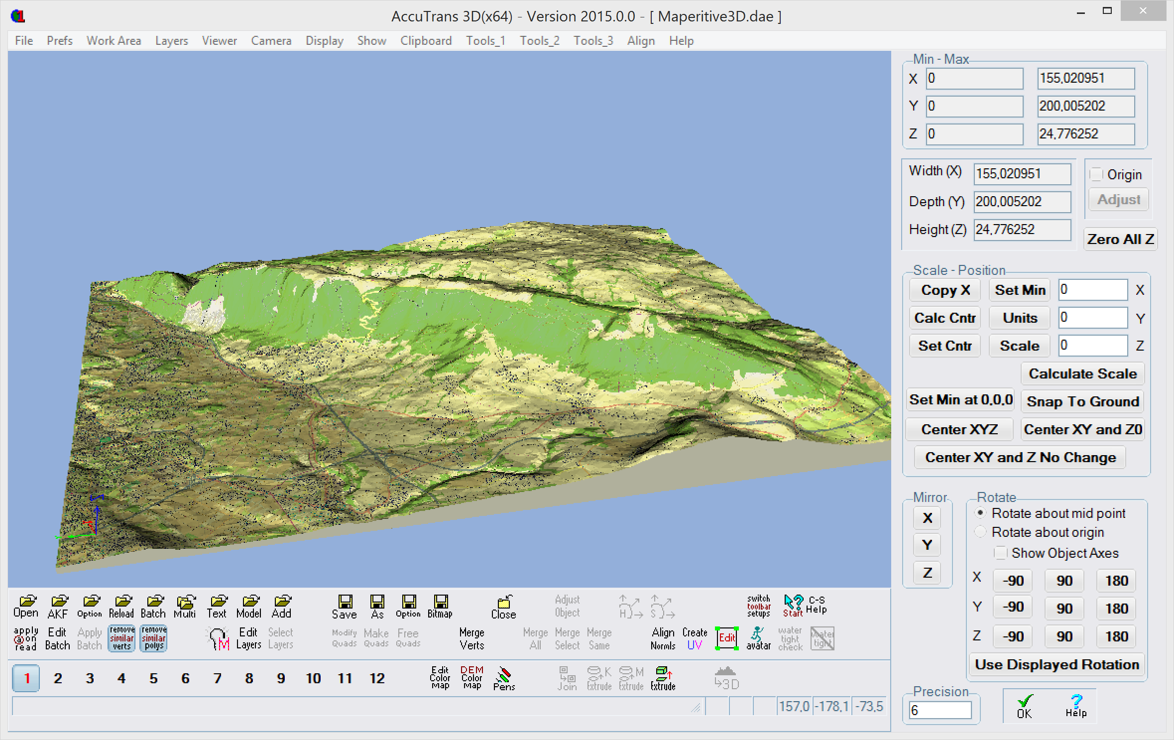
Model made with Maperitive (DEM data extraction from OSM maps) and bottom added with AccuTrans3D.
I strongly recommend buying Accutrans3D. It can save hours of work for the price of a few Euros.
Licensing
This is a screenshot of copyrighted computer software, and the copyright for its contents is most likely held by the author(s) or the company that created the software. It is believed that the use of a limited number of web-resolution screenshots is fair practice.
File history
Click on a date/time to view the file as it appeared at that time.
| Date/Time | Thumbnail | Dimensions | User | Comment | |
|---|---|---|---|---|---|
| current | 21:37, 15 March 2017 | | 2,358 × 1,486 (492 KB) | Daniel K. Schneider (talk | contribs) | Model made with Maperitive (DEM data extraction from OSM maps) and bottom added with AccuTrans3D. I strongly recommend buying Accutrans3D. It can save hours of work for the price of a few Euros. |
You cannot overwrite this file.
File usage
The following page uses this file: